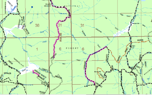
Open and closed roads in the Mountain City Ranger District
Trying to Understand the Travel Management Plan
By Larry Hyslop
Open and closed roads in the Mountain City Ranger District
Cindy claims it takes little to confuse me, so the U.S. Forest Service’s (USFS) Travel Management Plan is a given. So I talked to Troy Phelps, acting Mountain City District Ranger for the Humboldt-Toiyabe National Forest. I soon realized the issue is much too large for one column, so next week I will present the views opposed to such a plan.
Troy explained to me what the USFS is trying to do. First of all, it is a national directive to develop such a plan whose main goal is to protect the resources on our USFS land. The rest of the Humboldt-Toiyabe Forest has already developed Travel Management Plans for their areas, as have most of the forests across the country.
The main part of this plan forbids any motorized cross-country travel. Before this process began, the USFS claimed about 1,000 miles of authorized roads in its inventory. As part of the process they surveyed roads and found 1,500 miles of unauthorized roads that will be added to their road system. They also found 131 miles of roads that specifically need to be closed. Some of these roads are redundant since other roads lead to the same spot. Some harm the environment, perhaps because they travel along riparian areas.
Eighty five miles of authorized roads will be closed seasonably, usually during spring. These closures meet requirements of the Migratory Bird Act and protect nesting usually from February through May.
Some roads cross private land before becoming USFS roads. The USFS needs a permanent agreement between themselves and the private land owners concerning travel across private land. The USFS wants an easement in place before they list these roads beyond the private land as open. Some land owners have no problem with signing this agreement while others have already said they either do not want the public crossing their private land or do not want to sign a permanent agreement. Also, if it takes more than two years to work on such an easement, the USFS roads will be closed. These possibly closed roads are already included in the 131 miles already listed.
Of the 13 national forests in our region, most have Travel Management Plans in place that do not allow any off-road travel for retrieval of killed game. Our local ranger districts are looking at allowing off-road retrieval of elk only. Restrictions would include one trip by ATV, driven by the hunter themselves between the hours of 9am and 3pm and no more than one-half mile off an authorized road.
Dispersed camping will be allowed where such campsites existed in the past and limited to 150 feet off the road. Three large areas at Coon Summit, Maggie Summit and along the Charleston/Jarbidge Road will be allowed because such campsites already exist.
Authorized roads will be identified by signs and will be marked on maps. Closed roads will not be marked. This is a national directive and not negotiable.
The Jarbidge, Mountain City, and Ruby Mountains Ranger District offices will hold annual meetings with the plan in place to look at necessary adjustments to open/closed roads.
Elko Daily Free Press, “Nature Notes”, 11/3/2011
© Gray Jay Press, Elko, NV
Return to Elko Nature Notes